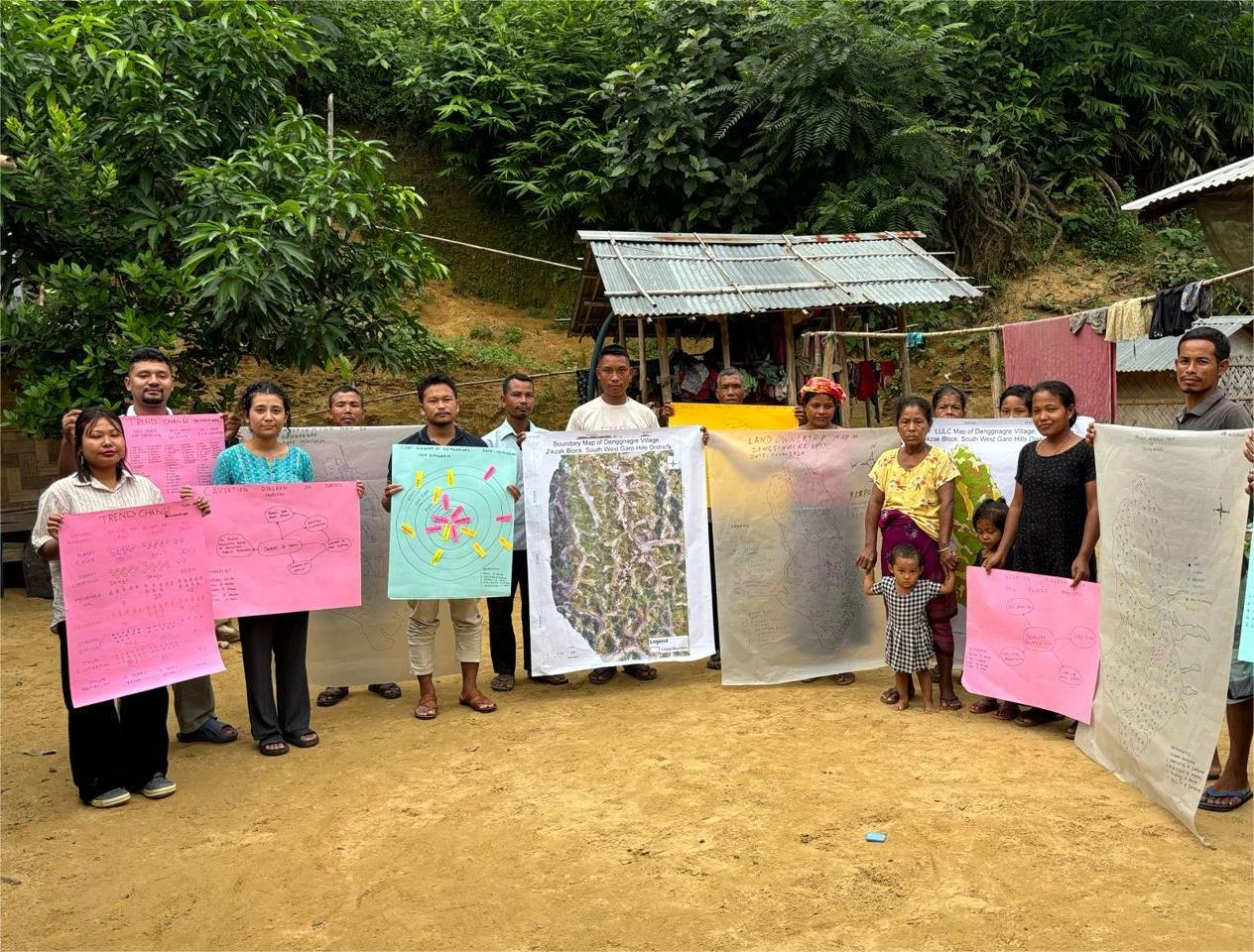
(Participatory Land Use Planning (PLUP) involves community members, including both men and women, conducting land use planning collaboratively).
Before making a microplan, which includes a forest management plan and a livelihood improvement plan, it is necessary to establish a land use plan to identify which part of a village is used for what purpose, covering the entire village area. In other words, land use zoning at the village level is prepared before making a microplan. This land use planning is conducted by community members, including men and women, in a participatory manner. This activity is called Participatory Land Use Planning (PLUP).
PLUP is similar to making a microplan prepared by a Joint Forest Management Committee (JFMC) according to guidelines developed by the central government agency. However, in the Project, the Joint Forest Management (JFM) scheme applies to only some parts of the project target area. In other areas, other schemes such as Village Reserve Forest (VRF) and Community Forest (CF) registered with the respective Autonomous District Council (ADC) are adopted for sustainable forest management. VRF or CF does not require the preparation of a microplan regulated by JFM guidelines. Therefore, PLUP is conducted uniformly across all target villages to ensure proper land use zoning at the village level from a long-term perspective.
Land Use Planning of Selected Sites at 1:10,000 Scale
For land use planning, the Project prepares four sets of maps:
- Land use/land cover maps
- Forest density maps
- Forest/vegetation type maps
- Topographic maps (e.g., roads, rivers, streams, contours, and settlements)
Based on inputs from land use zoning, a new set of maps is produced as the "land use zoning map," which displays zoning details. First, the land use/land cover maps are used for studying and estimating land use patterns of selected sites. Second, the forest density maps help assess the areas requiring conservation activities and identify open areas for plantations and other treatments. Third, the vegetation type maps support the study and estimation of existing vegetation types, potential Non-Timber Forest Products (NTFPs), and the need for planting materials. Fourth, the topographic maps assist in planning assets under Entry Point Activity (EPA) and measures for soil and water conservation.
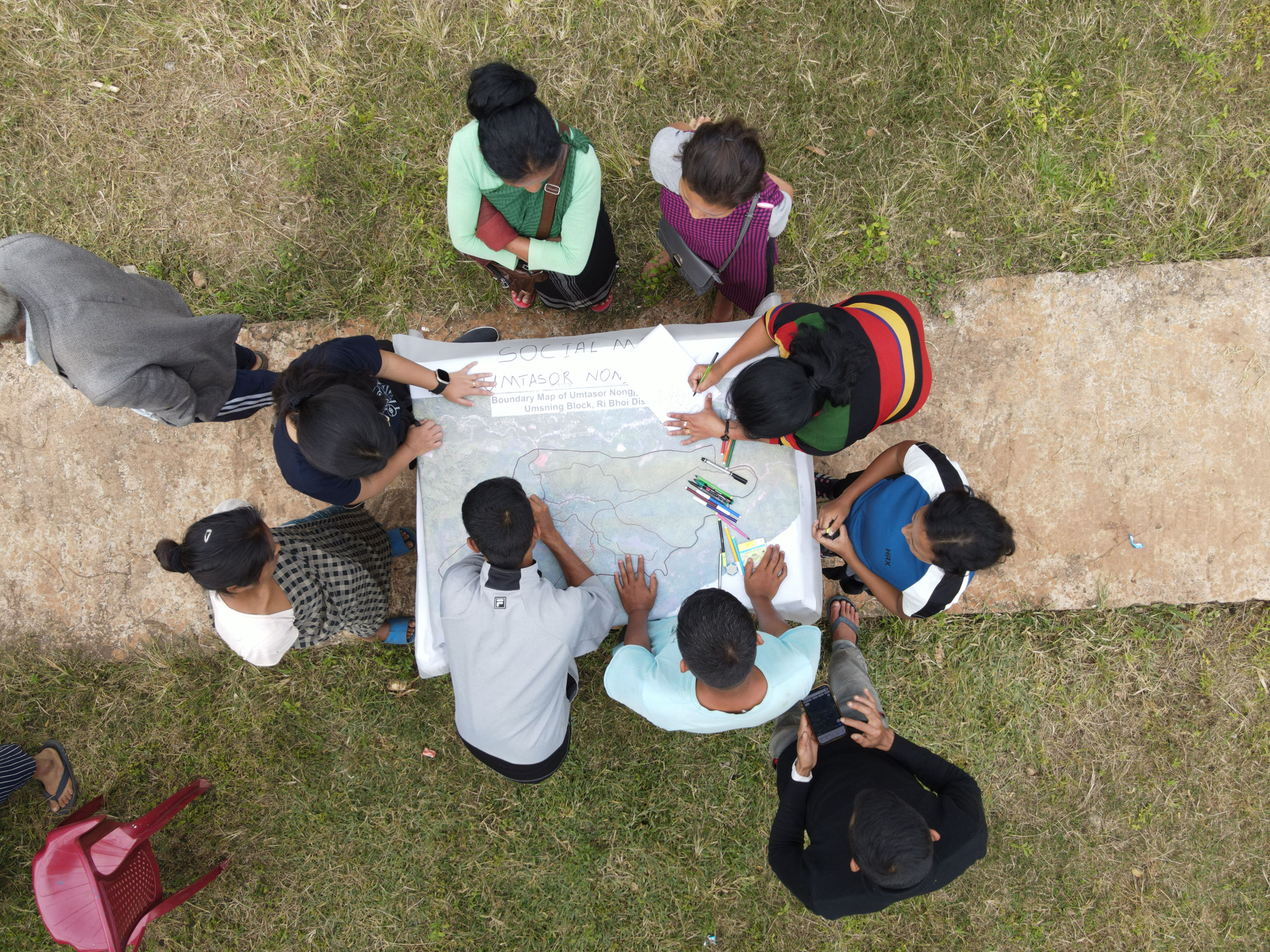
For effective land use planning, these maps are printed. Initially, maps are printed by block before selecting target villages or village clusters. Once target villages or clusters are selected and their boundaries are surveyed, maps are printed by village or village cluster at a 1:10,000 scale. Some villages or clusters may involve areas outside the surveyed boundaries for local activities, and maps are printed accordingly.
The GIS operator participates in meetings held by a sub-committee under the Village Employment Council (VEC) for the Project to explain the maps to the community and assist in detailed planning. The microplans are prepared using the Participatory Rural Appraisal (PRA) method, involving community members, and these maps serve as references for accurate planning.
Facilitation of Participatory Land Use Planning at Communities
PLUP involves community members, including men and women. NGOs hired for the project facilitate discussions and activities with villagers, specifically members of the micro-planning team or the sub-committee, with support from forest officials of the Forest and Environment Department (FED) or the Forest Department of the ADCs, officials of the Soil and Water Conservation Department (SWCD), and a GIS operator.